You are hereindia
india
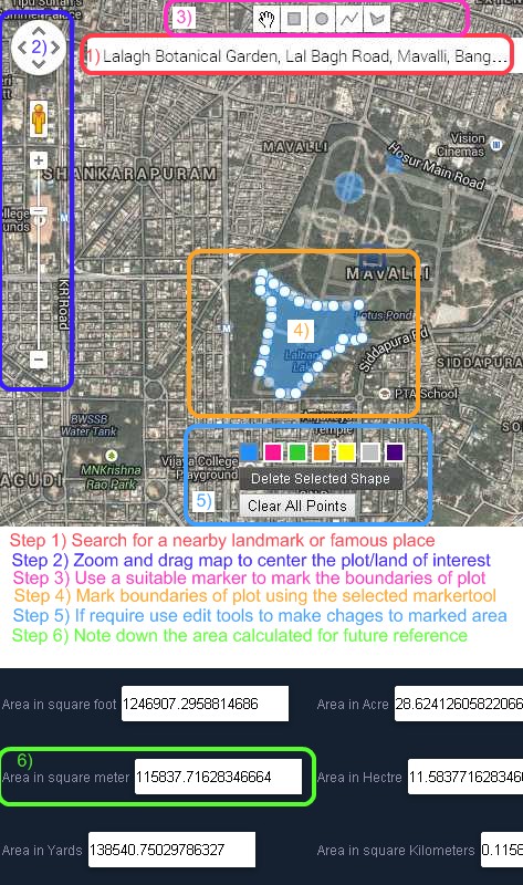
Google Maps Area Calculator Tool | Free Online Measure Land Area Tool

Getzy India Free Online Gmaps Area calculator usage steps

Measure Area of a Plot, Region in Cents, Square Meter,Acre Using Aerial Google Maps
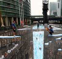
Largest 3D Street Art Ever


Video of making largest 3d street art which got Guinness World Record for the largest ever 3D street art.
Visit link for more Amazing 3D street art videos
Getzy Swiss Army Knife Tools

Get It done Eazily !. Getzy has a powerful database of many informative data about India, Currently we are powering many useful mobile applications.
University Grants Commission (UGC) National Eligibility Test (NET) Dates
University Grants Commission (UGC) conducts exams 2 times yearly for selecting college & university level lectureship and for award of Junior Research Fellowship (JRF) for Indian nationals for ensuring minimum standards for the entrants in the teaching profession and research.
Bangalore Weather Updates
Bangalore Weather (Maps)
View Weather at Bangalore in Google Maps, click on weather icon to get more info. Use zoom out to see the weather of other cities too.
Live Traffic maps provided by Google
Live Traffic Updates | MCTC Satellite Bus stand, Bangalore
MCTC Satellite Bus stand, Bangalore Live Traffic Map
Green colored road indicates smooth traffic, yellow indicates rather slow traffic, while red indicates very slow traffic, better to try alternative roads
Bangalore Live Traffic Map | Bangalore India Live Road Congestion
Bangalore Live Traffic Map
Green colored road indicates smooth traffic, yellow indicates rather slow traffic, while red indicates very slow traffic, better to try alternative roads
Bangalore Satellite Map
Google Satellite Maps/aerial satellite map view/hybrid satellite maps/road map/wikimapia map of Bangalore
Insat Satellite Image Kalpana-1 MER

INSAT IMAGE
Satellite Image Kalpana-1 MER

INSAT IMAGE
Insat 3D SECTOR IR COLOUR COMPOSITE IMAGE

INSAT IMAGE
SATELLITE IMAGES OF INSAT-3D

INSAT-3D SATELLITE IMAGES AND PRODUCTS


