
You are herebangalore
bangalore
Lal Bagh,Bangalore Area Measurement with Getzy Area Calculator
Our Free Online Area Calculator Tool is an excellent tool for quickly measuring area of any plot/land and is also good for making fast area estimates of abundant land. In this post we are using it to measure area of Lalbagh garden in Bangalore.
Using the marker tools in the map, the boundaries of garden are marked as shown in the first image below. Once the boundaries are marked the tool immediately calculates the area and converts to square feet, square meter, cents, hectres etc. as visible in the second image.
Wikipedia quotes the area of Lalbagh as 240 Acre, you can see that the area measured with our free tool in 2 minutes is 239.87 Acreage ie. more or less equal to the actual area of lalbagh. (Please refer the 3rd image below)
Bangalore Weather Updates
Bangalore Weather (Maps)
View Weather at Bangalore in Google Maps, click on weather icon to get more info. Use zoom out to see the weather of other cities too.
Live Traffic maps provided by Google
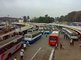
Live Traffic Updates | MCTC Satellite Bus stand, Bangalore
MCTC Satellite Bus stand, Bangalore Live Traffic Map
Green colored road indicates smooth traffic, yellow indicates rather slow traffic, while red indicates very slow traffic, better to try alternative roads
Bangalore Live Traffic Map | Bangalore India Live Road Congestion
Bangalore Live Traffic Map
Green colored road indicates smooth traffic, yellow indicates rather slow traffic, while red indicates very slow traffic, better to try alternative roads
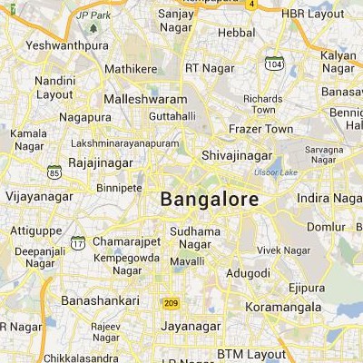
Bangalore Satellite Map
Google Satellite Maps/aerial satellite map view/hybrid satellite maps/road map/wikimapia map of Bangalore
Drunk driving: Breathalyser test by KSRTC - Bangalore Mirror
A couple of months ago, traffic police found a Karnataka State Road Transport Corporation (KSRTC) bus haphazardly parked in the busy Majestic area. The bus was affecting the flow of traffic so cops tracked down the driver and asked him to move the bus. The driver readily agreed, but his effort behind the wheel was so unsteady, that cops feared for the lives of pedestrians and other motorists. The driver was drunk.
3-day deadline for ATMs too short, customers take big hit - The Times of India
The government's knee-jerk reaction to shut over 1,000 unguarded ATMs in Bangalore is causing massive inconvenience. Long queues are springing up before ATMs, and walkins to bank branches are increasing. With the approaching salary weekend, the situation will get worse
Bangalore University Info, Facts, Gmaps | Google Satellite Maps
Facts about Bangalore University
* Campus
* Mark Johnson Addresses the Spectators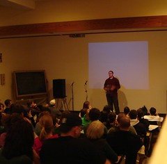
* Images courtesy Flickr.com and its vibrant members
Test RelatedInfo Filter
[RelatedFreshInfo:aggregated:bangalore,railways:25:500:0]
PNR STATUS Sms
Indian railways allow to do the PNR Status Check via cell phone and landphones. Use the following sms and call methods to do the pnr status check 24 hours via mobile enquiry. To sms request, a reply sms is immediately provided with details of current pnr status including the seat number and birth number if reservation confirmed. Please note that your service provider may charge for sms send.
Google Satellite Maps of Bangalore | Bangalore ಗೂಗಲ್ ನಕ್ಷೆಗಳ ಉಪಗ್ರಹ ವೀಕ್ಷಿಸಿ
Google satellite maps of Bangalore( Bangalore ಗೂಗಲ್ ಉಪಗ್ರಹ ನಕ್ಷೆಗಳು ವೀಕ್ಷಿಸಿ)
 .
.
Follow read more to view Bangalore Google satellite maps.
Google Earth Bangalore Banashankari Bus Stand Aerial Maps
Google Earth 3d view/aerial satellite map view/hybrid satellite maps/road map of Banashankari Bus station Bangalore
Google Satellite Map of Bangalore Shanti Nagar Bus stand
Google Earth 3d view/aerial satellite map view/hybrid satellite maps/road map of Bangalore Shanti Nagar Bus Stand
Google Satellite Map View of Satellite MCTC Bus stand Bangalore
Google Earth 3d view/aerial satellite map view/hybrid satellite maps/road map of MCTC Satellite Bus Stand Bangalore
Google Earth Satellite Maps of Bangalore Majestic Bus Stand ( Kempegowda Bus Station )
Google Earth 3d view/aerial satellite map view/hybrid satellite maps/road map of Majestic Bus Station ( Kempegowda Bus Station )
